Water Management in Payahuunadü
Learning Objectives
By the end of this module, you should be able to:
Understand how groundwater pumping can impact the surrounding landscape and ecology.
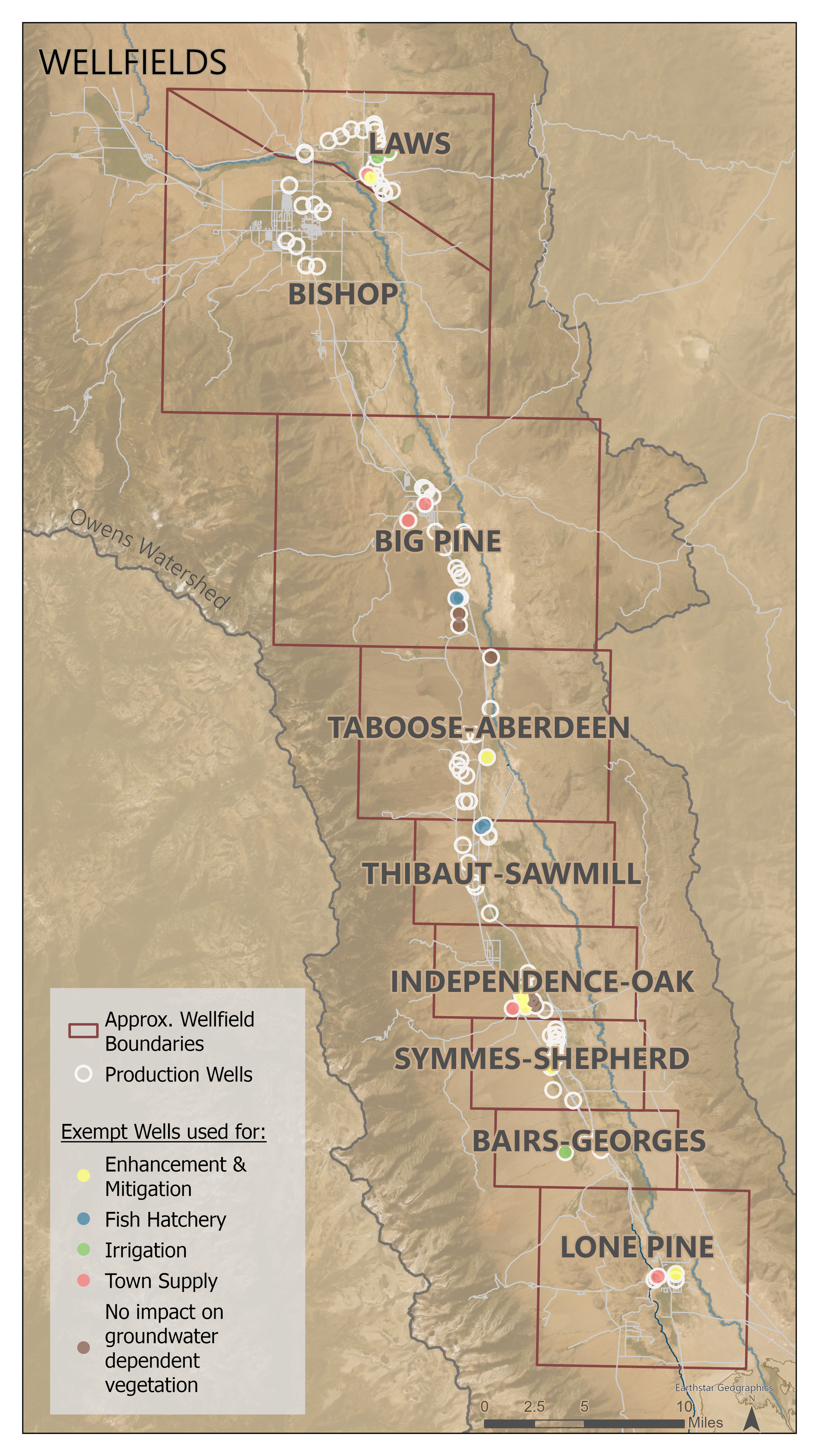
Understand how wells are distributed and grouped across the valley.
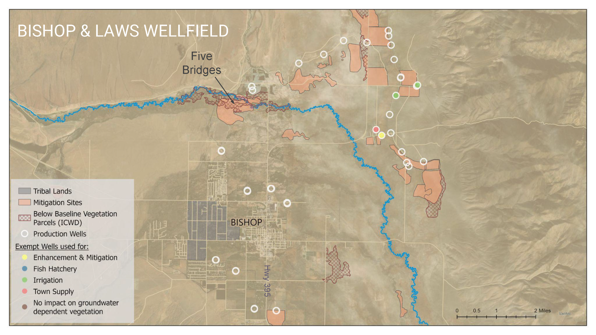
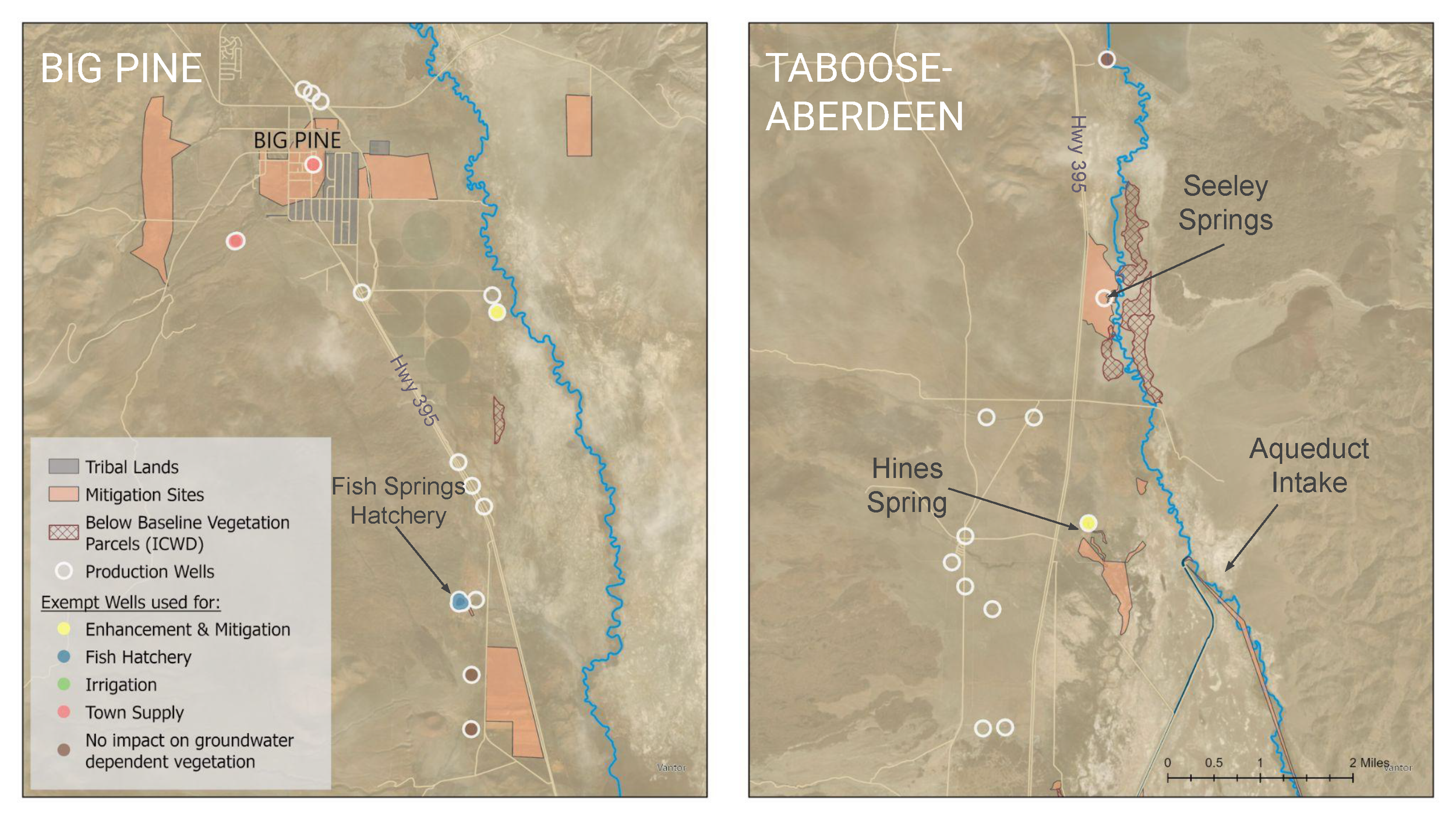
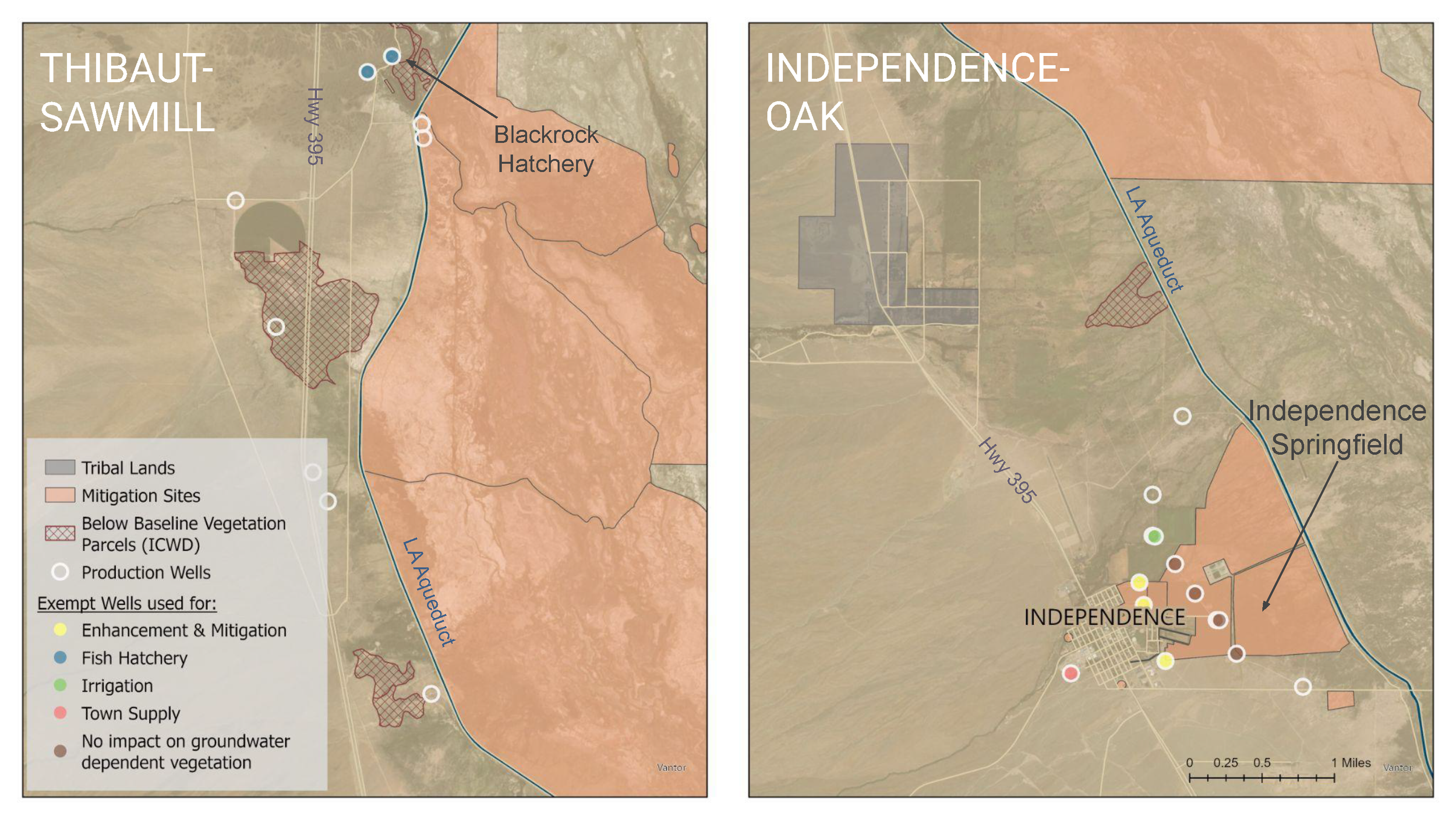
Identify if mitigation sites or below baseline parcels might be near where you live or have visited.
Please enjoy this recording of our April 16th Virtual Workshop with Water Empowerment Organizers, Emily & Charlene where we discuss the Impacts of Water Extraction in Payahuunadü.
Impacts from water extraction are far-reaching and affect nearly every aspect of life in Payahuunadü. These impacts deserve deeper discussion in the future, but this module focuses on the impacts from groundwater pumping and what that looks like in Payahuunadü.
Impacts to Springs and Riparian Areas
Groundwater pumping greatly increased in the early 1970s after construction of the second LA Aqueduct. Some of the most immediate visible impacts were to springs across the valley, which quickly dried up and reduced riparian habitat.
Infrastructure and Management Areas
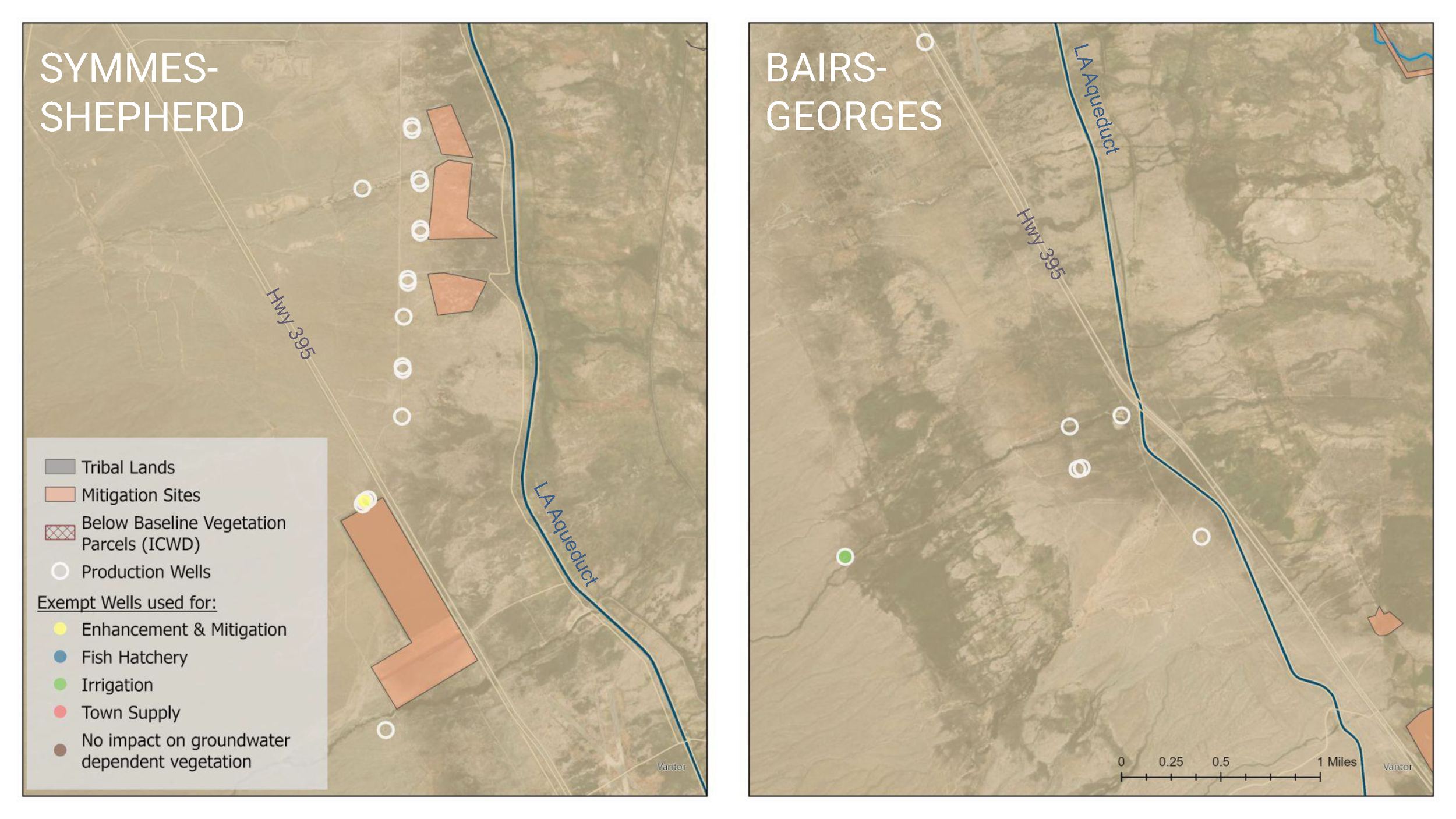
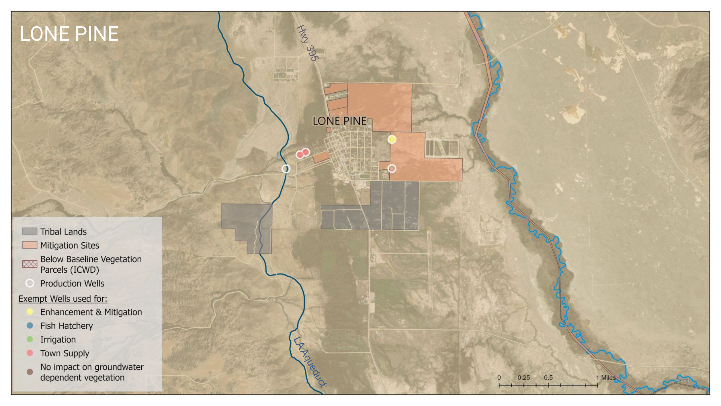
Previous modules covered important concepts related to groundwater pumping and mitigation projects. Groundwater pumping is usually quantified by wellfield when data is presented by LADWP. There are seven wellfields in the valley, shown here in maps with production wells, mitigation projects, and below baseline parcels.
Wellfields are groups of wells organized for monitoring and management purposes
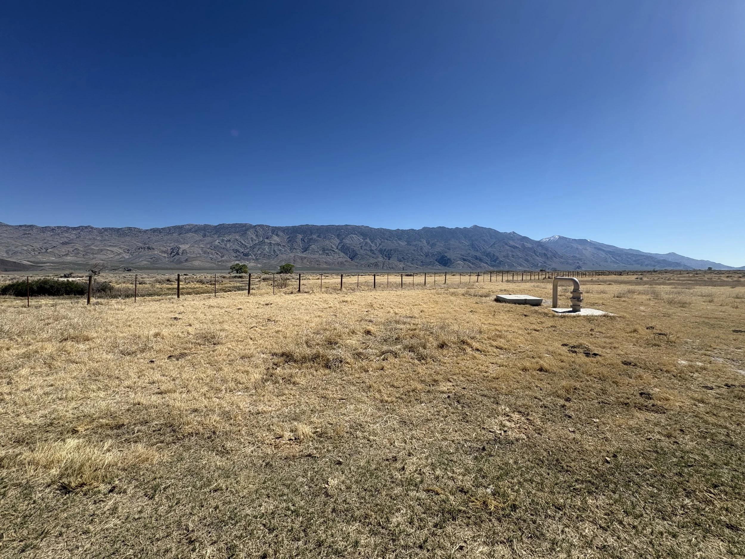
Production wells are wells that pump groundwater for use in the valley or export to Los Angeles
Mitigation projects are areas where LADWP is obligated to enhance the environment or mitigate the ecological impacts of groundwater pumping
Below baseline parcels are the areas identified by the Inyo County Water Department as having vegetation cover below the baseline established in the mid 1980s